Kentucky rescuers use 3-D technology to bring six college students out of Red River Gorge safely
Published 5:30 am Friday, April 2, 2021
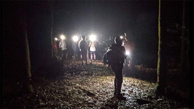
A Kentucky rescue team used 3D maps produced by laser data of the earth’s surface to rescue six college students who got lost hiking the Red River Gorge.
On Tuesday night, the Wolfe County Search and Rescue Team responded to a group of six college students who got lost while hiking in the Kentucky wilderness area.
The students, who were hiking on one of the area’s trails, when they reportedly made a wrong turn onto an unofficial “user-generated” trail that paralleled the Parched Corn Creek.
The group then got lost and traveled up steep drainage that was thick with vegetation.
Reaching the group was further complicated by a system of cliffs in the drainage area.
Thanks to the use of 3D maps produced by LIDAR technology the rescuers were able to identify a small gap in the cliff line that the team then used to access the students.
The students and rescue team were back to the safety of the trailhead by 4 a.m.
The rescue team asks that if you plan to hike the area, plan your trip ahead of time and know your route. They recommend you to bring a GPS or use the GPS on your phone, as well as a map and a compass. Make sure you have warm, dry layers of clothing as conditions can change quickly.


