Most rural counties in Kentucky
Published 10:31 am Monday, July 25, 2022
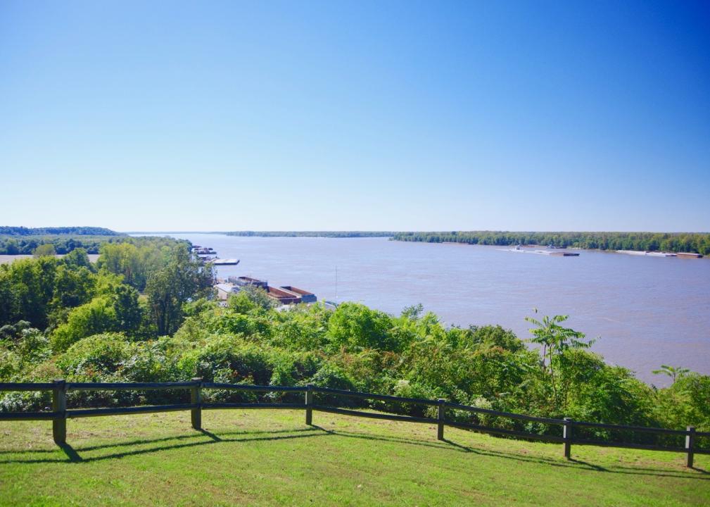
Brian Stansberry // Wikimedia Commons
Most rural counties in Kentucky
A surprising number of U.S. counties have 100% rural land-702, in fact. Stacker compiled a list of the most rural counties in Kentucky using data from the U.S. Census Bureau. Counties are ranked by the percent of land area that is rural, as of the 2010 Census, with ties broken by residents per square mile, according to 2020 5-year population estimates.
According to the Census Bureau, rural land encompasses any land that isn’t an urban area. To be considered an urban area, a place has to have a densely settled core of census tracts or blocks and count at least 2,500 people, at least 1,500 of whom must be residents of non-institutional buildings. Areas with 50,000 people or more are considered urbanized areas, while areas with between 2,500 and 50,000 people are considered urban clusters.
You may also like: States sending the most people to Kentucky
![]()

Nyttend // Wikimedia Commons
#50. Lawrence County
– Rural area: 99.4% (413 square miles)
– Urban area: 0.6% (3 square miles)
– Total land area: 416 square miles
— #29 largest county in state, #2,432 nationwide
– Population density: 37.5 people / square mile (15,604 residents)
— #29 lowest density county in state, #1,407 nationwide

FloNight (Sydney Poore) and Russell Poore // Wikimedia Commons
#49. Fleming County
– Rural area: 99.4% (347 square miles)
– Urban area: 0.6% (2 square miles)
– Total land area: 349 square miles
— #45 largest county in state, #2,683 nationwide
– Population density: 41.7 people / square mile (14,519 residents)
— #40 lowest density county in state, #1,511 nationwide

Ryan Emmick // Wikimedia Commons
#48. Hancock County
– Rural area: 99.5% (187 square miles)
– Urban area: 0.6% (1 square miles)
– Total land area: 188 square miles
— #108 largest county in state, #3,015 nationwide
– Population density: 46.6 people / square mile (8,748 residents)
— #47 lowest density county in state, #1,619 nationwide

Dcoetzee // Wikimedia Commons
#47. Trigg County
– Rural area: 99.5% (439 square miles)
– Urban area: 0.5% (2 square miles)
– Total land area: 441 square miles
— #21 largest county in state, #2,302 nationwide
– Population density: 33.0 people / square mile (14,569 residents)
— #20 lowest density county in state, #1,294 nationwide

Nyttend // Wikimedia Commons
#46. Trimble County
– Rural area: 99.5% (151 square miles)
– Urban area: 0.5% (1 square miles)
– Total land area: 152 square miles
— #116 largest county in state, #3,057 nationwide
– Population density: 56.2 people / square mile (8,528 residents)
— #59 lowest density county in state, #1,797 nationwide
You may also like: Most popular baby names for boys in Kentucky

JERRYE & ROY KLOTZ MD // Wikimedia Commons
#45. Hart County
– Rural area: 99.5% (410 square miles)
– Urban area: 0.5% (2 square miles)
– Total land area: 412 square miles
— #30 largest county in state, #2,454 nationwide
– Population density: 45.7 people / square mile (18,833 residents)
— #46 lowest density county in state, #1,596 nationwide

Nyttend // Wikimedia Commons
#44. Crittenden County
– Rural area: 99.5% (358 square miles)
– Urban area: 0.5% (2 square miles)
– Total land area: 360 square miles
— #41 largest county in state, #2,655 nationwide
– Population density: 24.8 people / square mile (8,940 residents)
— #5 lowest density county in state, #1,060 nationwide

Nyttend // Wikimedia Commons
#43. Breathitt County
– Rural area: 99.6% (490 square miles)
– Urban area: 0.4% (2 square miles)
– Total land area: 492 square miles
— #12 largest county in state, #2,112 nationwide
– Population density: 26.0 people / square mile (12,802 residents)
— #8 lowest density county in state, #1,098 nationwide

Nyttend // Wikimedia Commons
#42. Livingston County
– Rural area: 99.8% (312 square miles)
– Urban area: 0.2% (1 square miles)
– Total land area: 313 square miles
— #58 largest county in state, #2,778 nationwide
– Population density: 29.3 people / square mile (9,172 residents)
— #10 lowest density county in state, #1,193 nationwide

Nyttend // Wikimedia Commons
#41. Spencer County
– Rural area: 100.0% (187 square miles)
– Urban area: 0.0% (0 square miles)
– Total land area: 187 square miles
— #110 largest county in state, #3,017 nationwide
– Population density: 101.5 people / square mile (18,945 residents)
— #93 lowest density county in state, #2,264 nationwide
You may also like: Counties with the highest rate of food insecure children in Kentucky

Nyttend // Wikimedia Commons
#40. Gallatin County
– Rural area: 100.0% (101 square miles)
– Urban area: 0.0% (0 square miles)
– Total land area: 101 square miles
— #119 largest county in state, #3,087 nationwide
– Population density: 86.5 people / square mile (8,760 residents)
— #82 lowest density county in state, #2,145 nationwide

Nyttend // Wikimedia Commons
#39. Russell County
– Rural area: 100.0% (254 square miles)
– Urban area: 0.0% (0 square miles)
– Total land area: 254 square miles
— #80 largest county in state, #2,900 nationwide
– Population density: 70.4 people / square mile (17,846 residents)
— #69 lowest density county in state, #1,983 nationwide

Nyttend // Wikimedia Commons
#38. Letcher County
– Rural area: 100.0% (338 square miles)
– Urban area: 0.0% (0 square miles)
– Total land area: 338 square miles
— #53 largest county in state, #2,718 nationwide
– Population density: 64.9 people / square mile (21,936 residents)
— #63 lowest density county in state, #1,910 nationwide

Nyttend // Wikimedia Commons
#37. Henry County
– Rural area: 100.0% (286 square miles)
– Urban area: 0.0% (0 square miles)
– Total land area: 286 square miles
— #69 largest county in state, #2,827 nationwide
– Population density: 55.9 people / square mile (15,999 residents)
— #56 lowest density county in state, #1,790 nationwide

W.marsh // Wikimedia Commons
#36. Pendleton County
– Rural area: 100.0% (277 square miles)
– Urban area: 0.0% (0 square miles)
– Total land area: 277 square miles
— #75 largest county in state, #2,853 nationwide
– Population density: 52.6 people / square mile (14,587 residents)
— #52 lowest density county in state, #1,732 nationwide
You may also like: 13.8 percent of households in Kentucky receive food stamps

Nyttend // Wikimedia Commons
#35. Clinton County
– Rural area: 100.0% (197 square miles)
– Urban area: 0.0% (0 square miles)
– Total land area: 197 square miles
— #104 largest county in state, #3,000 nationwide
– Population density: 51.6 people / square mile (10,175 residents)
— #51 lowest density county in state, #1,718 nationwide

Nyttend // Wikimedia Commons
#34. Martin County
– Rural area: 100.0% (230 square miles)
– Urban area: 0.0% (0 square miles)
– Total land area: 230 square miles
— #93 largest county in state, #2,952 nationwide
– Population density: 49.7 people / square mile (11,421 residents)
— #50 lowest density county in state, #1,689 nationwide

W.marsh // Wikimedia Commons
#33. Bath County
– Rural area: 100.0% (279 square miles)
– Urban area: 0.0% (0 square miles)
– Total land area: 279 square miles
— #74 largest county in state, #2,852 nationwide
– Population density: 44.6 people / square mile (12,421 residents)
— #44 lowest density county in state, #1,564 nationwide

Nyttend // Wikimedia Commons
#32. Knott County
– Rural area: 100.0% (352 square miles)
– Urban area: 0.0% (0 square miles)
– Total land area: 352 square miles
— #43 largest county in state, #2,677 nationwide
– Population density: 42.8 people / square mile (15,041 residents)
— #42 lowest density county in state, #1,534 nationwide

Kybluegrass // Wikimedia Commons
#31. McCreary County
– Rural area: 100.0% (427 square miles)
– Urban area: 0.0% (0 square miles)
– Total land area: 427 square miles
— #26 largest county in state, #2,378 nationwide
– Population density: 40.6 people / square mile (17,333 residents)
— #38 lowest density county in state, #1,485 nationwide
You may also like: See how many rural hospitals in Kentucky have closed since 2005

Brian Stansberry // Wikimedia Commons
#30. Washington County
– Rural area: 100.0% (297 square miles)
– Urban area: 0.0% (0 square miles)
– Total land area: 297 square miles
— #65 largest county in state, #2,812 nationwide
– Population density: 40.5 people / square mile (12,044 residents)
— #37 lowest density county in state, #1,481 nationwide

Nyttend // Wikimedia Commons
#29. Bracken County
– Rural area: 100.0% (206 square miles)
– Urban area: 0.0% (0 square miles)
– Total land area: 206 square miles
— #98 largest county in state, #2,989 nationwide
– Population density: 40.4 people / square mile (8,308 residents)
— #36 lowest density county in state, #1,479 nationwide

Huw Williams (Huwmanbeing) // Wikimedia Commons
#28. Edmonson County
– Rural area: 100.0% (303 square miles)
– Urban area: 0.0% (0 square miles)
– Total land area: 303 square miles
— #63 largest county in state, #2,804 nationwide
– Population density: 40.3 people / square mile (12,195 residents)
— #35 lowest density county in state, #1,476 nationwide

Nyttend // Wikimedia Commons
#27. Magoffin County
– Rural area: 100.0% (308 square miles)
– Urban area: 0.0% (0 square miles)
– Total land area: 308 square miles
— #59 largest county in state, #2,790 nationwide
– Population density: 40.0 people / square mile (12,346 residents)
— #34 lowest density county in state, #1,466 nationwide

Bedford // Wikimedia Commons
#26. Webster County
– Rural area: 100.0% (332 square miles)
– Urban area: 0.0% (0 square miles)
– Total land area: 332 square miles
— #55 largest county in state, #2,733 nationwide
– Population density: 39.2 people / square mile (13,021 residents)
— #33 lowest density county in state, #1,461 nationwide
You may also like: Counties with the oldest homes in Kentucky

W.marsh // Wikimedia Commons
#25. Jackson County
– Rural area: 100.0% (345 square miles)
– Urban area: 0.0% (0 square miles)
– Total land area: 345 square miles
— #46 largest county in state, #2,691 nationwide
– Population density: 38.7 people / square mile (13,368 residents)
— #32 lowest density county in state, #1,446 nationwide

Nyttend // Wikimedia Commons
#24. Lyon County
– Rural area: 100.0% (214 square miles)
– Urban area: 0.0% (0 square miles)
– Total land area: 214 square miles
— #95 largest county in state, #2,976 nationwide
– Population density: 38.5 people / square mile (8,226 residents)
— #31 lowest density county in state, #1,439 nationwide

Nyttend // Wikimedia Commons
#23. Green County
– Rural area: 100.0% (286 square miles)
– Urban area: 0.0% (0 square miles)
– Total land area: 286 square miles
— #70 largest county in state, #2,828 nationwide
– Population density: 38.5 people / square mile (11,000 residents)
— #30 lowest density county in state, #1,438 nationwide

Nyttend // Wikimedia Commons
#22. Nicholas County
– Rural area: 100.0% (195 square miles)
– Urban area: 0.0% (0 square miles)
– Total land area: 195 square miles
— #105 largest county in state, #3,004 nationwide
– Population density: 36.8 people / square mile (7,189 residents)
— #28 lowest density county in state, #1,394 nationwide

Nyttend // Wikimedia Commons
#21. McLean County
– Rural area: 100.0% (252 square miles)
– Urban area: 0.0% (0 square miles)
– Total land area: 252 square miles
— #82 largest county in state, #2,903 nationwide
– Population density: 36.4 people / square mile (9,202 residents)
— #26 lowest density county in state, #1,382 nationwide
You may also like: Highest-earning counties in Kentucky

Nyttend // Wikimedia Commons
#20. Casey County
– Rural area: 100.0% (444 square miles)
– Urban area: 0.0% (0 square miles)
– Total land area: 444 square miles
— #20 largest county in state, #2,290 nationwide
– Population density: 35.9 people / square mile (15,968 residents)
— #25 lowest density county in state, #1,365 nationwide

Hunter Hawley // Wikimedia Commons
#19. Breckinridge County
– Rural area: 100.0% (567 square miles)
– Urban area: 0.0% (0 square miles)
– Total land area: 567 square miles
— #6 largest county in state, #1,807 nationwide
– Population density: 35.8 people / square mile (20,283 residents)
— #24 lowest density county in state, #1,362 nationwide

Nyttend // Wikimedia Commons
#18. Morgan County
– Rural area: 100.0% (381 square miles)
– Urban area: 0.0% (0 square miles)
– Total land area: 381 square miles
— #37 largest county in state, #2,597 nationwide
– Population density: 34.8 people / square mile (13,270 residents)
— #23 lowest density county in state, #1,339 nationwide

Nyttend // Wikimedia Commons
#17. Metcalfe County
– Rural area: 100.0% (290 square miles)
– Urban area: 0.0% (0 square miles)
– Total land area: 290 square miles
— #68 largest county in state, #2,825 nationwide
– Population density: 34.7 people / square mile (10,062 residents)
— #22 lowest density county in state, #1,336 nationwide

W.marsh // Wikimedia Commons
#16. Lee County
– Rural area: 100.0% (209 square miles)
– Urban area: 0.0% (0 square miles)
– Total land area: 209 square miles
— #96 largest county in state, #2,986 nationwide
– Population density: 33.9 people / square mile (7,088 residents)
— #21 lowest density county in state, #1,315 nationwide
You may also like: Fastest-growing counties in Kentucky

Acdixon // Wikimedia Commons
#15. Todd County
– Rural area: 100.0% (374 square miles)
– Urban area: 0.0% (0 square miles)
– Total land area: 374 square miles
— #40 largest county in state, #2,620 nationwide
– Population density: 32.9 people / square mile (12,334 residents)
— #19 lowest density county in state, #1,292 nationwide

Nyttend // Wikimedia Commons
#14. Wolfe County
– Rural area: 100.0% (222 square miles)
– Urban area: 0.0% (0 square miles)
– Total land area: 222 square miles
— #94 largest county in state, #2,966 nationwide
– Population density: 32.4 people / square mile (7,188 residents)
— #18 lowest density county in state, #1,283 nationwide

Brian Stansberry // Wikimedia Commons
#13. Monroe County
– Rural area: 100.0% (329 square miles)
– Urban area: 0.0% (0 square miles)
– Total land area: 329 square miles
— #56 largest county in state, #2,738 nationwide
– Population density: 32.2 people / square mile (10,616 residents)
— #17 lowest density county in state, #1,278 nationwide

Jonathunder // Wikimedia Commons
#12. Ballard County
– Rural area: 100.0% (247 square miles)
– Urban area: 0.0% (0 square miles)
– Total land area: 247 square miles
— #86 largest county in state, #2,921 nationwide
– Population density: 32.1 people / square mile (7,914 residents)
— #16 lowest density county in state, #1,275 nationwide

Nyttend // Wikimedia Commons
#11. Elliott County
– Rural area: 100.0% (234 square miles)
– Urban area: 0.0% (0 square miles)
– Total land area: 234 square miles
— #90 largest county in state, #2,939 nationwide
– Population density: 31.8 people / square mile (7,461 residents)
— #15 lowest density county in state, #1,268 nationwide
You may also like: Best places to live in Kentucky

Nyttend // Wikimedia Commons
#10. Menifee County
– Rural area: 100.0% (204 square miles)
– Urban area: 0.0% (0 square miles)
– Total land area: 204 square miles
— #100 largest county in state, #2,992 nationwide
– Population density: 31.7 people / square mile (6,463 residents)
— #14 lowest density county in state, #1,264 nationwide

W.marsh // Wikimedia Commons
#9. Owen County
– Rural area: 100.0% (351 square miles)
– Urban area: 0.0% (0 square miles)
– Total land area: 351 square miles
— #44 largest county in state, #2,678 nationwide
– Population density: 30.9 people / square mile (10,847 residents)
— #13 lowest density county in state, #1,233 nationwide

Brian Stansberry // Wikimedia Commons
#8. Butler County
– Rural area: 100.0% (426 square miles)
– Urban area: 0.0% (0 square miles)
– Total land area: 426 square miles
— #27 largest county in state, #2,384 nationwide
– Population density: 29.9 people / square mile (12,756 residents)
— #12 lowest density county in state, #1,212 nationwide

C. Bedford Crenshaw // Wikimedia Commons
#7. Lewis County
– Rural area: 100.0% (483 square miles)
– Urban area: 0.0% (0 square miles)
– Total land area: 483 square miles
— #14 largest county in state, #2,147 nationwide
– Population density: 27.6 people / square mile (13,345 residents)
— #9 lowest density county in state, #1,140 nationwide

Nyttend // Wikimedia Commons
#6. Leslie County
– Rural area: 100.0% (401 square miles)
– Urban area: 0.0% (0 square miles)
– Total land area: 401 square miles
— #33 largest county in state, #2,521 nationwide
– Population density: 25.1 people / square mile (10,081 residents)
— #7 lowest density county in state, #1,074 nationwide
You may also like: 17% of people live near toxic release facilities—here’s how it breaks down in Kentucky

Nyttend // Wikimedia Commons
#5. Carlisle County
– Rural area: 100.0% (189 square miles)
– Urban area: 0.0% (0 square miles)
– Total land area: 189 square miles
— #106 largest county in state, #3,013 nationwide
– Population density: 25.0 people / square mile (4,738 residents)
— #6 lowest density county in state, #1,068 nationwide

JERRYE & ROY KLOTZ MD // Wikimedia Commons
#4. Owsley County
– Rural area: 100.0% (197 square miles)
– Urban area: 0.0% (0 square miles)
– Total land area: 197 square miles
— #102 largest county in state, #2,998 nationwide
– Population density: 22.4 people / square mile (4,416 residents)
— #4 lowest density county in state, #975 nationwide

Nyttend // Wikimedia Commons
#3. Cumberland County
– Rural area: 100.0% (305 square miles)
– Urban area: 0.0% (0 square miles)
– Total land area: 305 square miles
— #62 largest county in state, #2,800 nationwide
– Population density: 21.8 people / square mile (6,660 residents)
— #3 lowest density county in state, #956 nationwide

W.marsh // Wikimedia Commons
#2. Robertson County
– Rural area: 100.0% (100 square miles)
– Urban area: 0.0% (0 square miles)
– Total land area: 100 square miles
— #120 largest county in state, #3,088 nationwide
– Population density: 21.4 people / square mile (2,139 residents)
— #2 lowest density county in state, #939 nationwide

Brian Stansberry // Wikimedia Commons
#1. Hickman County
– Rural area: 100.0% (242 square miles)
– Urban area: 0.0% (0 square miles)
– Total land area: 242 square miles
— #88 largest county in state, #2,925 nationwide
– Population density: 18.4 people / square mile (4,461 residents)
— #1 lowest density county in state, #834 nationwide
You may also like: Best public high schools in Kentucky