Kentucky River expected to crest above 40 feet for first time in 11 years
Published 5:25 am Friday, March 5, 2021
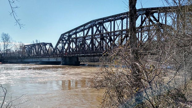
After a week of creeping toward major flood stage, the Kentucky River is now expected to crest above 40 feet for the first time in nearly 11 years.
The National Weather Service in Louisville projects that the river will crest at 40.1 feet at 1 a.m. Friday. It will be the ninth highest crest of all-time and the highest since May 5, 2010, when it reached 42.84 feet.
Throughout the week, NWS predicted that the river would crest at 39.9 feet — just below major flood stage, which starts at 40 feet — on Thursday afternoon.
However, as the river approached 39.91 feet on Thursday morning NWS increased its forecast of both the height and timing of the crest.
By 1:15 p.m. Thursday the river level had swelled to 39.99 feet and it hit the 40-foot mark at 3 p.m.
Minor flood stage starts at 31 feet and moderate flood stage starts at 35 feet.
“No significant drop in water level is expected until Saturday,” said Frankfort-Franklin County Emergency Management Director Tommy Russell.
A flood warning remains in effect until 5:09 a.m. Sunday.
The NWS projects that the Kentucky River will drop below 35 feet Saturday afternoon and fall below 31 feet at 1 a.m. Sunday. By midday Sunday, the water level is expected to sink to 26.1 feet.
Mayor Layne Wilkerson and Judge-Executive Huston Wells declared a local state of emergency, which will allow the Office of Emergency Management, both local governments and all emergency responders to provide any assistance and resources to citizens affected by the emergency, due to flooding from both the Kentucky River and Elkhorn Creek.
The declaration is in effect for weather events that began Feb. 26 and are ongoing.
An emergency hotline has been established for residents needing assistance and may be reached at 502-352-2252.
According to NWS, at 40 feet Paul Sawyier Drive, East Second Street, East Fourth Street, Admirals Landing, the entrance to McDonald Ferry Road and warehouses around Great Buffalo Trace Road flood.
At least 17 roads have already been affected by rising water.
The following roads are closed in Frankfort:
• 900 block of Kentucky Avenue
• Buffalo Alley, off St. Clair Street
• North Stoney Creek
• Riverboat Landing, off Wapping Street
• Lewis Ferry Road, near Buffalo Trace
• Stoney Creek Road
• Benson Valley Road, near Snow Hill
• 3000 block of Shadrick Ferry Road
• 2500 block of Glenns Creek Road
• Polsgrove Street
• Travis Circle
• Taylor Avenue between Benson Valley Road and Devils Hollow Road
• Benson Avenue near Rose
• Big Eddy from the East-West Connector to Travis Circle
• Glenns Creek Road at Harrod Carter
• Old Lawrenceburg Road from the Capitol garage to the East-West Connector
• South end of Swallowfield Road
Roadway issues may be reported to the Frankfort Dispatch Center at 502-875-8582.